The Desert Turns to the Sun
The Vidal Energy Project
A century after Parker Dam first wired this valley for power, a utility-scale solar and battery-storage project is proposed on roughly 1,090 acres of the Vidal mesa — the same desert the Chemehuevi hunted, prospectors mined, and Patton's tanks crossed, now studied acre by acre before it changes again.
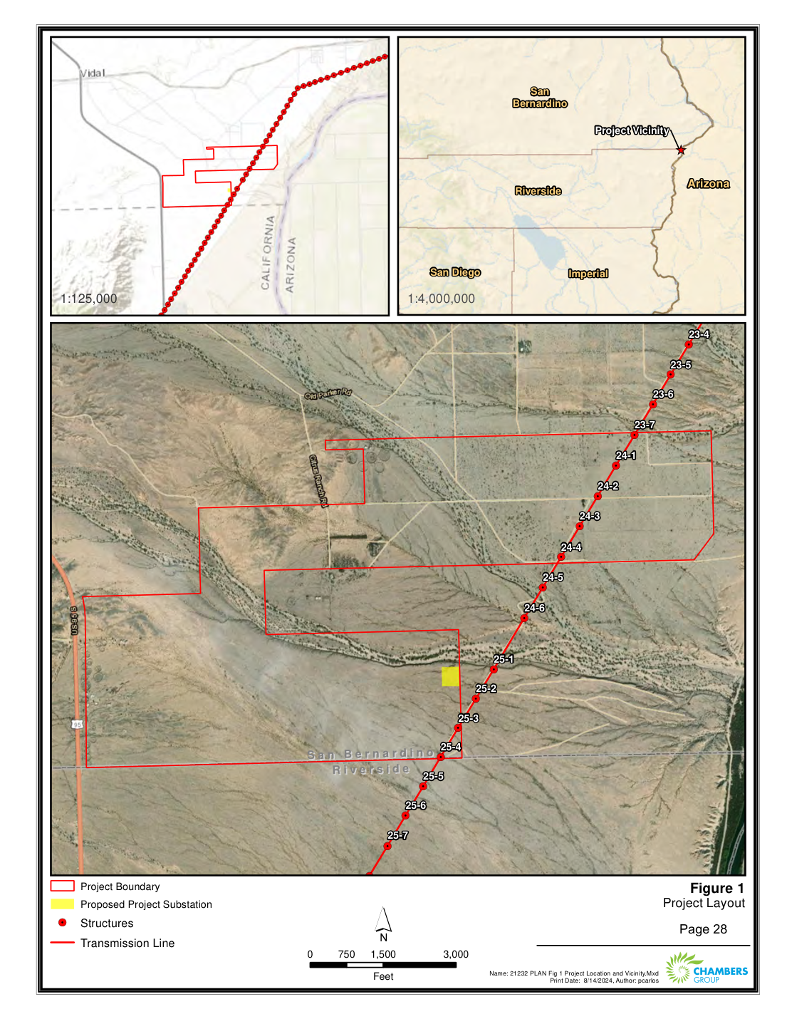
Every era of Vidal's recorded history has turned on the same two facts of geography: a great river close at hand, and an enormous quantity of sun and open ground. The Chemehuevi farmed the river's floodplain; prospectors chased gold into the Riverside Mountains; the Metropolitan Water District ran an aqueduct through the valley; Patton trained an army on its flats; and after the war a lattice of transmission lines carried Colorado River power across the desert. The newest chapter proposed for this ground draws on both facts at once. It is called the Vidal Energy Project — a utility-scale solar photovoltaic and battery-storage facility proposed for roughly 1,090 acres of the mesa between US-95 and the Colorado River.
The project is proposed by CDH Vidal LLC, of Mahwah, New Jersey, and was studied for permitting by the consulting firm Chambers Group, Inc., of San Diego. Its environmental filings — biological, cultural, air-quality, and visual studies prepared in 2020 through 2022 — are the reason so much of this desert's deep past has been documented in the first place. To build on the land, its history and its living things first had to be surveyed and written down. The record those studies produced is worth preserving in its own right, and much of what follows is drawn directly from it.
A solar farm on the Vidal mesa
The project area lies in southeastern San Bernardino County, about 41 miles north of Blythe and 58 miles south of Needles, along the western margin of the Colorado River Indian Tribes Reservation and immediately adjacent to the river — at its closest, roughly 1,800 feet from the Colorado, on a mesa terrace some 85 feet above the water. As proposed, arrays of photovoltaic panels and a battery-storage system would occupy the open desert inside the project boundary, with a substation and a short generation-tie transmission line connecting the facility into the existing power grid that already crosses the valley.
Where the desert meets the river
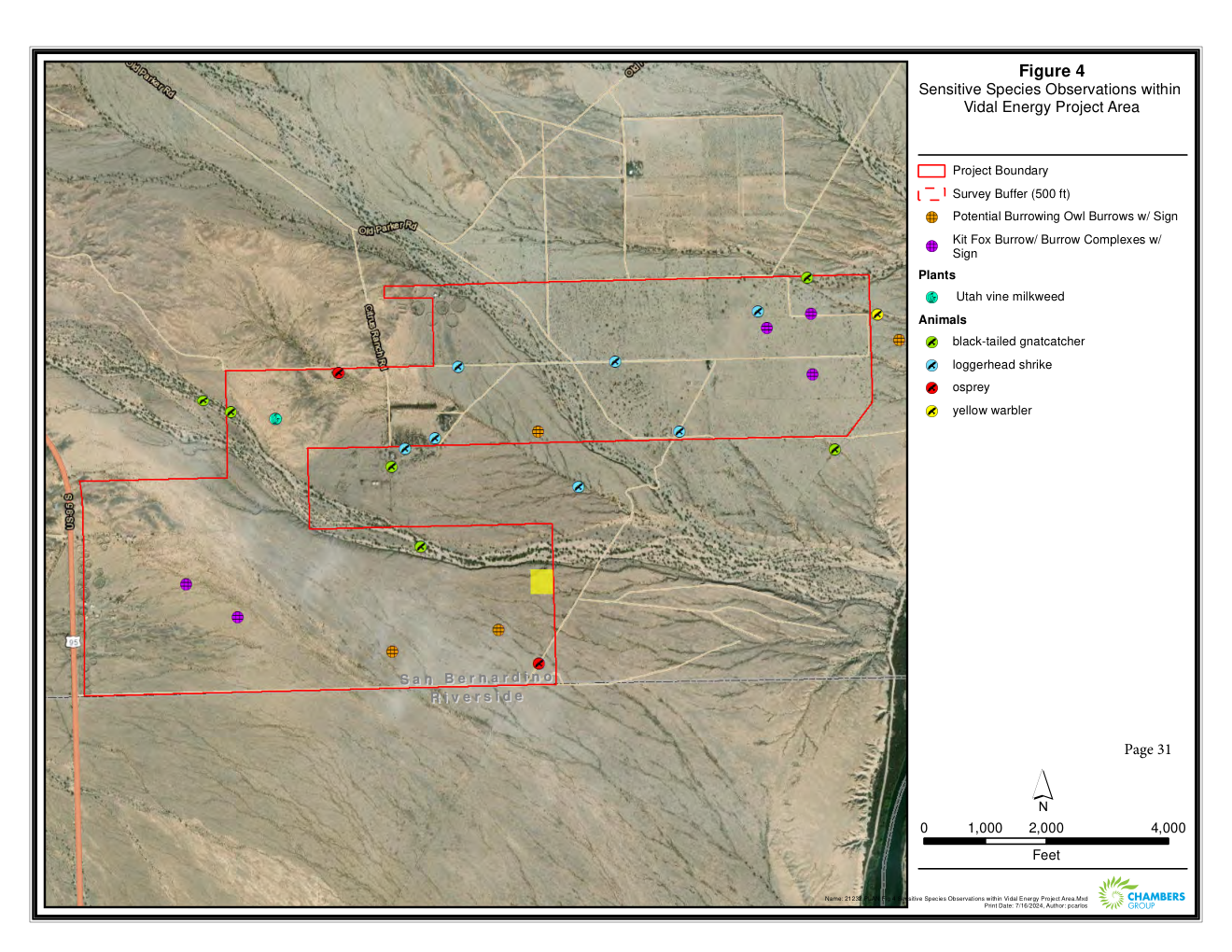
The studies place the site at the northernmost edge of the Sonoran Desert, at the point where it laps against the Mojave along the Colorado. It is a spare, hot country: the nearby town of Vidal averages July highs of about 108 °F and receives only some five inches of rain a year. Geologically the mesa is built of old river deposits laid down when a brackish sea once reached beyond Needles, later backfilled by the Colorado. Botanists mapping the ground found it dominated by creosote bush scrub — more than 900 of the project's acres — threaded by two large desert washes of blue palo verde and ironwood woodland, the green arteries where most of the area's life concentrates.
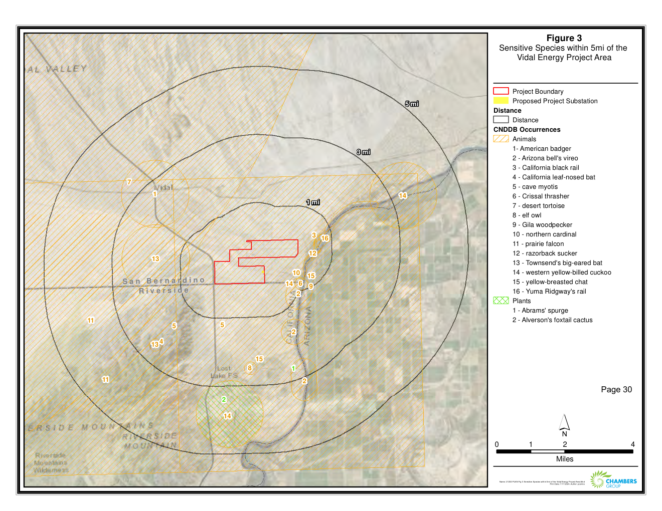
The wildlife surveys turned up exactly the residents a desert-and-river edge should hold. Biologists flagged potential burrowing-owl burrows and desert kit fox burrow complexes, marked a stand of the uncommon Utah vine milkweed, and recorded birds moving along the washes and the river corridor — the black-tailed gnatcatcher, loggerhead shrike, osprey, and yellow warbler among them. The same washes that draw these animals are the features a solar layout must work around, and the maps that document them are, incidentally, a small natural-history portrait of the Vidal mesa as it stands today.
Reading the land before it changes
Before any ground is disturbed, California law requires that its cultural record be searched. Chambers Group's archaeologists walked the entire project area and, through a records search at the South Central Coastal Information Center at Cal State Fullerton, tied their findings into everything previously known here. Their survey recorded 53 new archaeological sites and 11 isolated finds within the 1,090 acres — a density that quietly confirms how thoroughly this "empty" desert was used. The artifacts span thousands of years, from ancient stone tools such as Lake Mojave and Elko projectile points to the buff ware and red-on-buff pottery of the Patayan, the lower-Colorado ceramic tradition of the ancestral Mohave and Chemehuevi.
That report is also the thread tying this project back through the whole of the Society's collection. Its history chapter traces the Calzona gold rush in the Riverside Mountains, the coming of the Santa Fe railroad and the naming of Vidal for Hansen Brownell's son-in-law, the homestead patents filed across these sections in 1919–1920, Patton's Desert Training Center, and even the 1964 Cold War war game Exercise Desert Strike, whose mock river crossing was staged near the mouth of Vidal Wash. The land proposed for solar panels is, in other words, a palimpsest — and the environmental file reads almost as an index to the eras gathered elsewhere on this site.
What the view would become
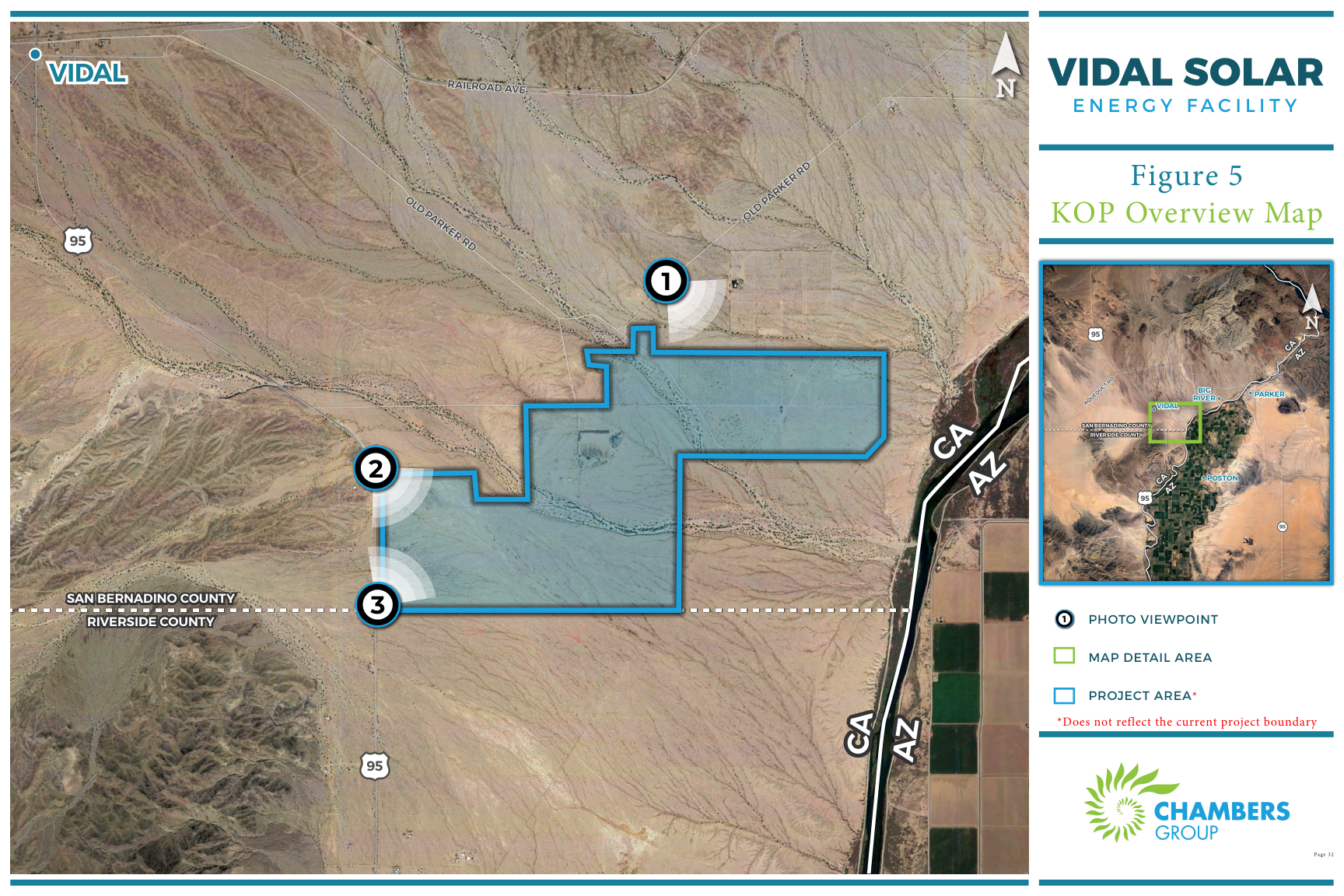
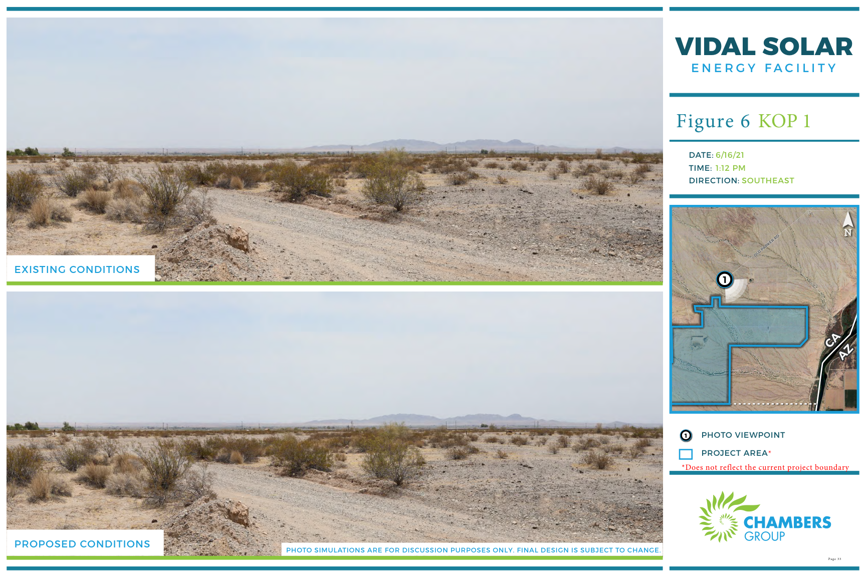
To show how the desert would look with the facility built, the visual study photographed the site from key observation points along the surrounding roads and then rendered the proposed panels into each scene. The paired images below — existing conditions above, simulated conditions below — are the clearest picture of the change on offer: low rows of panels spreading across the creosote flats beneath the same unbroken desert mountains and sky.
A century of power in one valley
There is a fitting symmetry to the site. Crossing the eastern edge of the project area is the Parker–Blythe No. 1 line, a 161-kilovolt wood-pole transmission line built in 1950–1951 to carry hydroelectric power from Parker Dam — the same dam whose reservoir drowned 8,000 acres of Chemehuevi farmland and whose aqueduct turned Vidal into a boomtown in the 1930s. For seventy years that line has moved river-made electricity across the desert. Now a project proposes to add sun-made electricity to the same grid, in the same valley, a few hundred feet away.
Whether and in what form the Vidal Energy Project is ultimately built is a matter for regulators, the county, and the tribes and public who weigh in on it. The Vidal Historical Society takes no position on that question. What the Society records is simpler: that in the third decade of the twenty-first century, the desert around Vidal was surveyed more closely than at any time in its history — its plants counted, its animals mapped, its buried past inventoried — because someone proposed to turn its sunlight into power. Every earlier era here was, in its way, an argument about what this hard and beautiful country is for. This is merely the latest.
Sources & Further Reading
- Cultural Resources Survey Report for the Vidal Energy Project, San Bernardino County, California — Chambers Group, Inc., for CDH Vidal LLC (November 2020; revised March 2022). Records search via the South Central Coastal Information Center, CSU Fullerton.
- Vidal Energy Project biological survey and sensitive-species mapping (Figures 2–4), Chambers Group, Inc. — vegetation communities and wildlife observations within the project area.
- Vidal Energy Project visual-resources study (Figures 5–8): KOP overview map and photo simulations from key observation points, photographed June 16, 2021, Chambers Group, Inc.
- R. Meyer, Western Area Power Administration, Desert Southwest Region Facilities Historic Context Statement (2014), and SWCA (2003) — history of the Parker–Blythe No. 1 (PAD-BLY 1) 161-kV transmission line, built 1950–1951.
- U.S. Bureau of Reclamation — Parker Dam (constructed 1934–1938) and the Colorado River Aqueduct system.