The Great Public Works
The Colorado River Aqueduct Boom
In the depths of the Depression, one of the largest public works of its age marched across the Mojave — and for a few frenzied years it turned the empty crossroad at Vidal into a corridor of camps, cash, and hard-drinking labor.
Los Angeles in the 1920s was a city outrunning its own water supply. The Owens Valley aqueduct that had fed its first great boom was no longer enough, and civic leaders across the growing coastal plain understood that the region's future depended on tapping the one reliable source within reach: the Colorado River, some 240 miles to the east across two of the harshest deserts in North America.
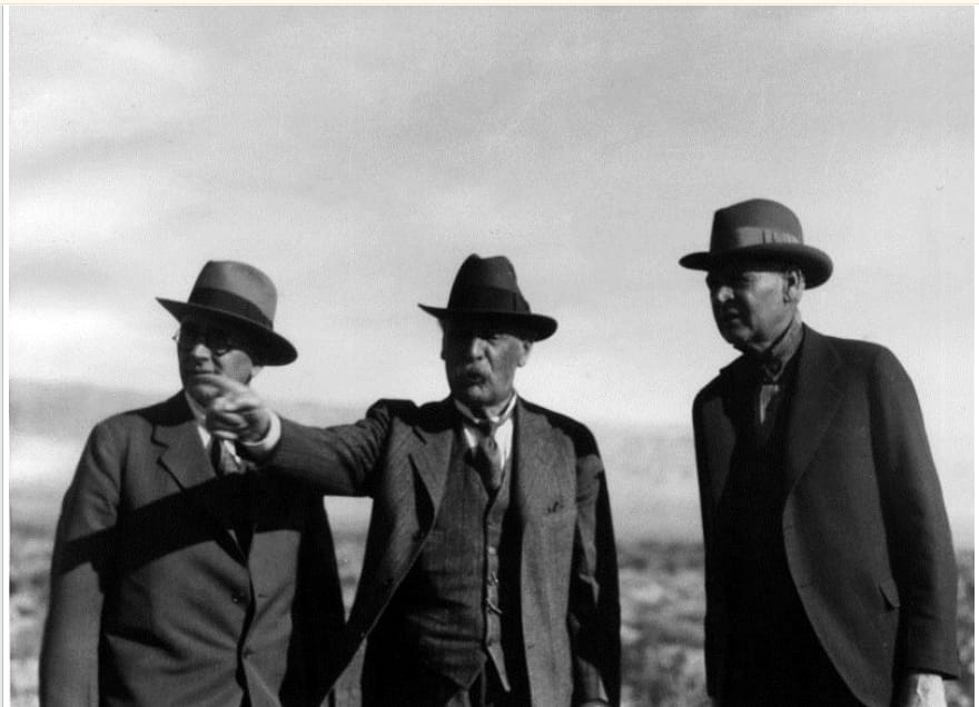
The idea belonged to William Mulholland, the self-taught engineer who had already brought Owens Valley water south. Beginning in 1923 he sent survey parties east on a four-year hunt for a workable alignment, and in 1925 Los Angeles voters approved a $2 million bond just to pay for the engineering. To actually build the thing, thirteen cities banded together in 1928 to form the Metropolitan Water District of Southern California. In 1931 the district's voters — many already feeling the first blows of the Depression — approved a staggering $220 million bond, and out of eight possible routes the board chose the one anchored on a new dam at Parker. That line ran straight through the desert country around Vidal.
A river turned west
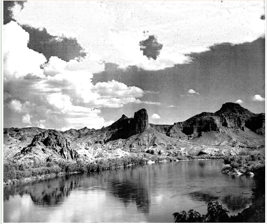
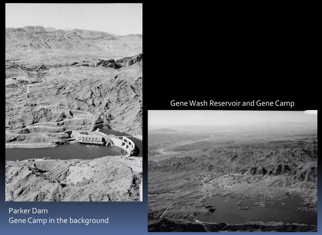
The Colorado is one of the great rivers of the continent, gathering the snowmelt of a 245,000-square-mile watershed on the western slope of the Rockies. Where the aqueduct meets it — just below the confluence with the Bill Williams River — engineers first had to tame it. Parker Dam, built by the U.S. Bureau of Reclamation between 1934 and 1938 with Metropolitan's money, backed the river up into 45-mile-long Lake Havasu, a forebay and desilting basin for the aqueduct. To reach bedrock the crews excavated some 233 feet below the original riverbed, and Parker earned the title of the deepest dam in the world.
From the intake behind Parker Dam the system runs 242 miles west to the coastal plain, lifted over the desert ranges by five great pumping plants — an undertaking the American Society of Civil Engineers would later name one of the Seven Modern Civil Engineering Wonders of the United States. But for Vidal, the stretch that mattered was the very first one.
Gene Camp and the desert intake near Vidal
The first — and, for the country around Vidal, the most consequential — stretch of the aqueduct lies in the barren hills just west of the river. From the Whitsett Intake Pumping Plant at the edge of Lake Havasu, two miles upstream of Parker Dam, the water is lifted 291 feet up a sheer mountainside and into the first of the tunnels. A few miles on, the Gene Pumping Plant raises it another 303 feet. Around that plant grew Gene Camp, with its own reservoirs at Gene Wash and Copper Basin held behind dams in the desert — a permanent operating settlement in otherwise empty land. It is here, at Gene Camp in the Vidal Valley desert of eastern California, that the American Society of Civil Engineers fixed the coordinates of its historic-landmark plaque.
Canals, siphons, and tunnels across the Vidal country
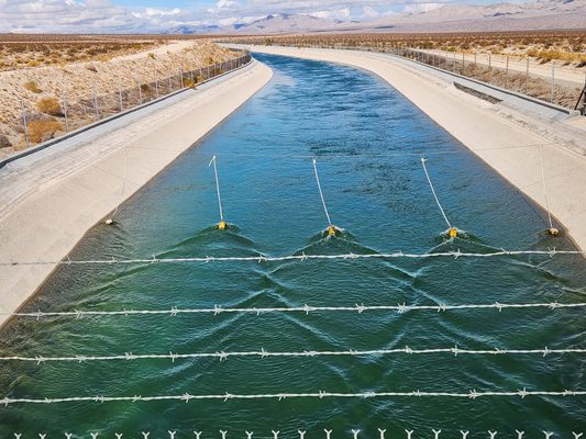
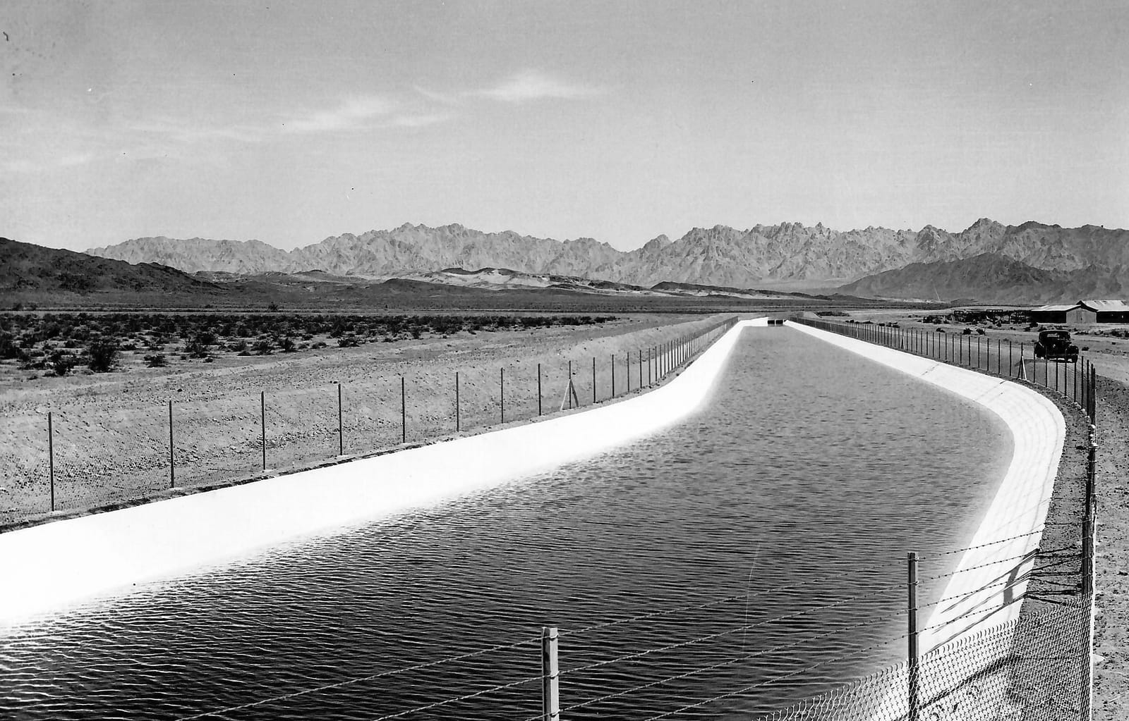
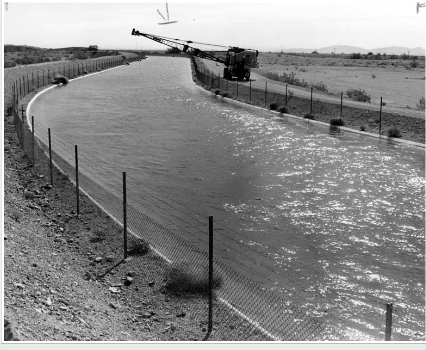
Beyond the intake, where the aqueduct crosses the flat open desert of the Vidal Valley and the basins to its west, the line takes the form of long concrete-lined canals — 63 miles of them in all — running arrow-straight between chain-link fences toward the next range of mountains. Where the ground rose or fell away, the crews switched to covered conduit, then to the great siphons that dip across the washes and climb the ridgelines.
The boom at Vidal
For the quiet siding at Vidal, the aqueduct arrived like a flood of its own. Over the eight-year project the Metropolitan Water District put some 30,000 to 35,000 men on its payroll — as many as 10,000 at a time — making it the largest work opportunity in Southern California during the Depression. To house and feed the crews boring tunnels and grading the line through the surrounding valley, the district threw up temporary townsite camps almost overnight, and the population of the corridor swelled from a handful of railroad and mining families into a churning labor force numbering in the thousands. What had been bare creosote flats became, for a few years, one of the busiest stretches of the eastern California desert.
The county moved to give the boom a permanent shape. A wire dispatch from Vidal at the outset of the project described a village that until then had held only a railroad station on the Santa Fe's Phoenix branch, a hotel, a post office, a general store, a filling station, and a boarding house. Now the San Bernardino County planning commission had approved an ambitious townsite plan, and crews were preparing to lay domestic water mains, pave the main streets, and raise business buildings in anticipation of the workmen expected once tunneling began through the nearby Whipple Mountains.
By the summer of 1933 the plan had taken visible form. A Los Angeles townsite company had secured a full section of land at Vidal — where C. H. Brownell had kept the store for a quarter century — built two stone arches at the town's entrances, piped it for water, and installed an electric plant that first lit the streets in February 1933. Its fifty residences were filled, with lumber yards, a theater, and a dance hall going up, and the boom even gave the town its own newspaper, the Vidal Herald, edited by M. G. “Watty” Watkins.
The timing sharpened the frenzy. Prohibition was repealed in 1933, just as the camps filled, and the Vidal valley corridor sprouted a remarkable density of liquor-serving establishments to slake a thirsty and cash-flush workforce. County license ledgers from the boom record dozens of such places along the corridor — saloons, roadhouses, and dance halls that ran hard through the desert nights.
Where there was drink, wages, and exhausting labor, there was also friction. The sheriff's records of the period include accounts of large, alcohol-fueled brawls among rival crews — the tunnel-blasting gangs in particular — serious enough to require heavy details of deputies dispatched from the county seat. For a brief window, Vidal was as raucous as any frontier boomtown, a generation after the frontier was supposed to have closed.
The water that remained
The camps did not last. As the line was completed and the crews moved on, the townsite camps were struck and the corridor emptied nearly as quickly as it had filled. Water first ran the length of the aqueduct in early 1939, and by 1941 it was delivering Colorado River water to the coast — one of the foundations on which modern Southern California was built. It has done so ever since; by 1977 the line was running brimful, some 20 percent above its original design capacity.
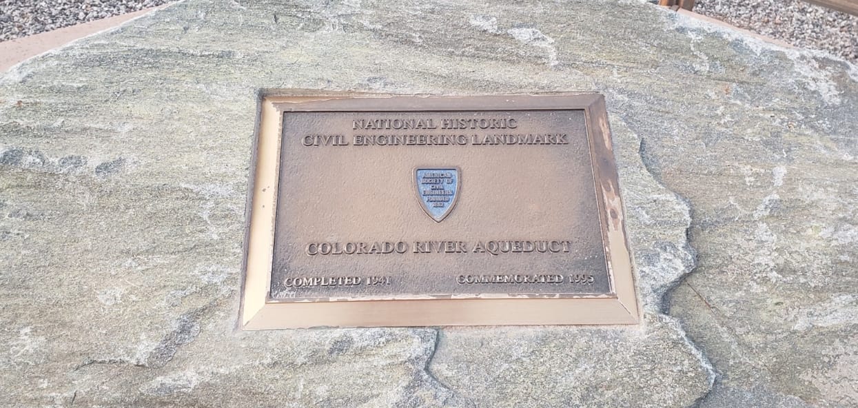
In 1995 the American Society of Civil Engineers set a bronze plaque in the desert stone to mark the aqueduct as a National Historic Civil Engineering Landmark — its official location given simply as Gene Camp, in the desert near Vidal. Today the concrete channel still slides its blue-green water across the Vidal Valley, quiet and unremarked by the few who pass. It is easy to miss how much history moved through this ground — that for a handful of Depression years, the making of a great public work turned an empty crossroad into a place of thousands, then let it fall silent again.
Sources & Further Reading
- American Society of Civil Engineers — Colorado River Aqueduct historic landmark (location: Gene Camp, CA).
- Water and Power Associates — "Construction of the Colorado River Aqueduct," with historical photographs.
- Water and Power Associates — "Mulholland and the Colorado River Aqueduct."
- Maven's Notebook — "Colorado River Aqueduct" explainer (route, pumping plants, and Metropolitan Water District).
- Historic American Engineering Record — Colorado River Aqueduct (canals, pumping plants, and power system drawings).
- Atlas Obscura — the Colorado River Aqueduct across the desert.
- "Thirteen Golden Cities," Metropolitan Water District of Southern California (film).
- "Vidal Valley," Wikipedia — the valley through which the aqueduct runs.